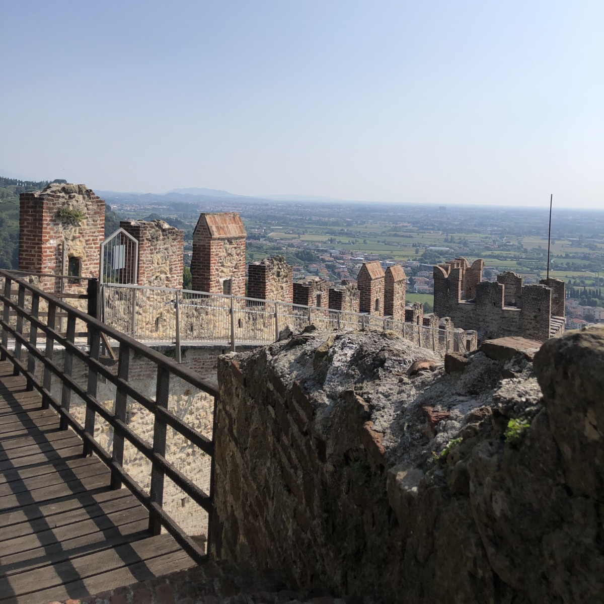
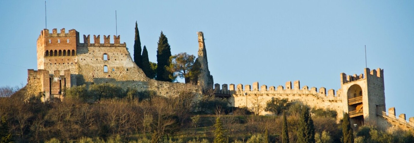
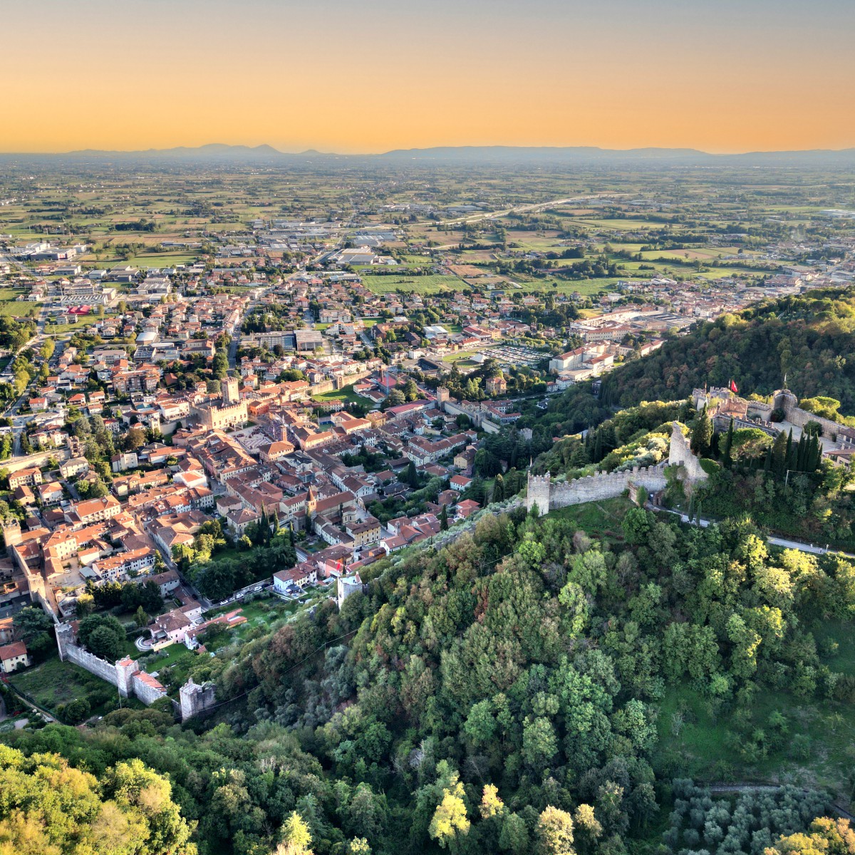
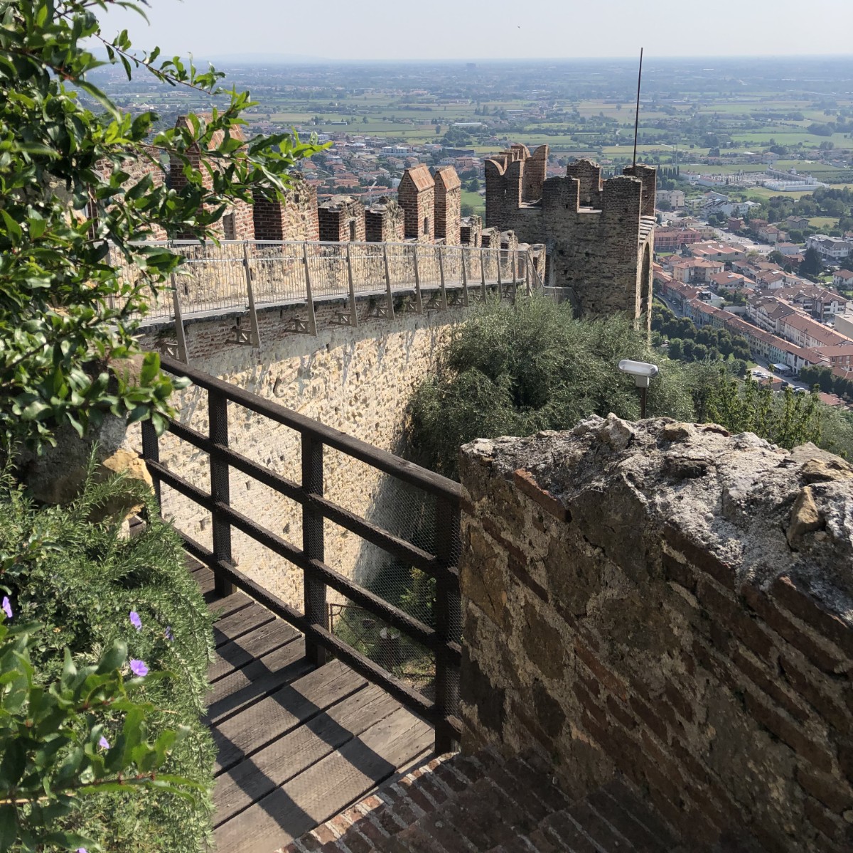
Chemin de Ronde

Chemin de Ronde

Access to this thrilling route is along the Carmini Path, an age-old route in the shade of the vegetation of the Salin Patk that leads to the Upper Castle. The chemin de ronde is about 70 cm wide, and features the original stone steps, merlons and embrasures. It can be walked along wearing a light harness, similar to the type used for an easy via ferrata, which is connected to a shuttle that is run along a track so that the steep slopes can be tackled safely. The 250 steps and the spectacular scenery make for an unforgettable experience.

Opening times and tickets

Opening
Open on every Sunday and public holiday from March to November.
Opening times
10:30 am - 1.00 pm / 1:30 pm - 6.00 pm 
Ticket
Full-price € 5,00

Concessions € 3,00 *
Combined ticket € 11,00 ***
* Children under 14, groups of more than 20 people.
** Chemin de Ronde + Lower Castle.

Discover the Chemin de Ronde

The view
The view
Considering the modest altitude of 248 metres, the view really is exceptional, and on a clear day, the Venetian lagoon is easily visible. The view spreads across the large Venetian plain and the Berici and Euganei hills, before stretching out towards the Piccole Dolomiti and the Pasubio. From there, it continues beyond the internal valleys of Marostica and the reliefs that divide them, on to Mount Corno and the spurs of the Asiago Plateau, ending up on the Grappa Massif to the east, at the foot of which runs the Brenta River, before stretching out across the hills of Asolo and the Montello, on the right bank of the Piave.

The Town Walls

The Town Walls
The Town Walls
It was in 1372 that Cansignorio della Scala from Verona completed the defensive fortifications of Marostica, with the construction of the Town Walls. The work, using local sandstone, began on March 1st and took around 3 years, involving the construction of 24 towers, two of them used as gates, and almost 2 km of curtain walls that joined the two castles, one on a hill and the other on the plain. The walls were crenelated all the way along, with a chemin de ronde, and with a height and thickness that varied depending on the land. The sensationally impressive end result would change the outline of the piedmont area forever.
Eastern sector
Eastern sector
The long stretch of curtain walls rises up on the hill with a height ranging from 8 to 12 metres, connecting with 7 protruding crenelated turrets 60 metres apart from one another, some of which were used for civil rather than military purposes following the decline of the Republic of Venice. They are joined to the Chemin de Ronde, a relatively uniform tier that stops before the Upper Castle for reasons of military security. In the 1990s, a wooden bridge replaced the original drawbridge used to clear defenders from the glacis. This section was opened to the public in 2014, with access requiring the use of a lightweight harness connected to a shuttle that runs along a track.
Western sector
Western sector
The defensive structure, composed of 7 curtain walls and 7 turrets, is almost entirely visible, to prevent enemy entrenchment. Inside the towers, beneath a fine round arch, is the wooden decking of the floor surface, double the thickness on the hill to overcome the significant difference in the level of the ground, and the two entrances that lead onto the chemin de ronde. This section is not currently open to the public.